
Cardiology
Fatherhood May Raise Risk of Heart Disease
While the Moon has been mapped in intricate detail over the last several decades, what steps can be taken to improve these images to provide safer landing and exploration sites for future human missions to the lunar surface? This is what a recent study published in The Planetary Science Journal hopes to address as a pair of researchers from Brown University have developed a new mapping technique called shape-from-shading that could revolutionize how 3D surface maps of the Moon are made and holds the potential to help future mission planners with landing site selection for the Artemis missions to the lunar south pole.
For the study, the researchers used computer algorithms to streamline the process of developing precise maps, which traditionally requires a lot of time and resources to develop since lighting conditions within the images make interpreting shadows and terrain difficult. However, these new computer algorithms greatly decrease the amount of time required to develop these maps by better-identifying surface terrain height and lighting angles, thus improving the accuracy of the maps, hence the name “shape-from-shading”.
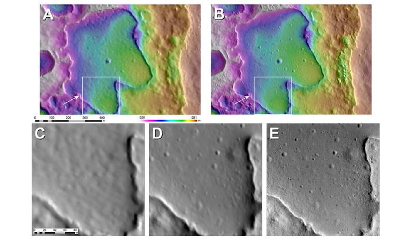
Figure 4 of the study depicting current lunar terrain models (A,C, and D0 compared with the shape-from-shading models developed from this study (B and E). (Credit: B.Boatwright, NASA/Goddard Space Flight Center/Ames Research Center)
“These new map products are significantly better than what we had in exploration planning during the Apollo missions, and they will very much improve the mission planning and scientific return for Artemis and robotic missions,” said Dr. James Head, who is a professor of geological sciences at Brown University, along with working on the Apollo program, and is co-author of the study.
This study comes as NASA plans to land the first woman and person of color on the lunar surface within the next few years under the agency’s Artemis program. This shape-from-shading method could prove beneficial since the astronauts will be landing at the lunar south pole where the terrain is poorly-lit.
How will shape-from-shading help develop better lunar maps in the coming years and decades? Only time will tell, and this is why we science!
As always, keep doing science & keep looking up!
Sources: The Planetary Science Journal, EurekAlert!, Brown University, NASA