Alaskan Glacier "Body Scan" Reveals Risks to Glacier's Future
A team of researchers led by the University of Arizona (UArizona) conducted a radar “body scan” of Alaska’s Malaspina Glacier, which is the largest piedmont glacier in the world, and revealed interior channels underneath the glacier that could cause a higher rate of glacier retreat if seawater makes its way into these channels due to erosion of the glacier’s coastal barrier.
"The loss of this glacier would likely be the largest loss of ice from an Alaskan glacier within this century," said Brandon Tober, who is a PhD student in the UArizona Department of Geosciences, and lead author of the study.
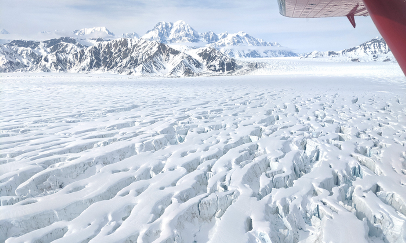
Image of Malaspina Glacier in southeast Alaska. (Credit: Brandon Tober/University of Arizona)
Tober notes the front permafrost region of Malaspina is “wasting away” as a result of increasing global temperatures from climate change, with permafrost meaning ground that stays frozen for two years or longer.
"As this coastal barrier erodes and gives way to large lagoons, primarily through the collapse of ice cliffs, ocean water may eventually gain access to the glacier," said Tober. "Once it gets to the front of the glacier, it may melt the ice even faster and initiate the glacier's retreat."
For the study, the researchers used the Arizona Radio Echo Sounder (ARES), to conduct a “body scan” of Malaspina to ascertain its overall shape and thickness. ARES is an instrument developed by Dr. Jack Holt, who is a professor in the UArizona Lunar and Planetary Laboratory and Department of Geosciences, and a co-author on the study.
Airplance flyover of Malaspina Glacier and St. Elias Mountains on June 1, 2022.
This study was part of the NASA-funded Operation IceBridge, which spanned from 2009 to 2021 and used airplanes to measure yearly thickness variances of sea ice, glaciers, and ice sheets across Alaska, Antarctica, and Greenland, with ARES being mounted on one of these aircraft.
During the aerial traverses, ARES used its ice-penetrating radar to conduct a “3D body scan” of both Malaspina and the bedrock underneath. Their findings indicated that Malaspina could potentially add 134 cubic miles (560 cubic kilometers) of ice to the global oceans, which could result in rising sea levels of just below 1/16 of an inch (1.4 millimeters).
"This might not sound like much, but to put this in perspective, all Alaskan glaciers combined contribute about 0.2 millimeters per year to global sea level rise – a rate that tops all other glaciated regions on Earth apart from the Greenland and Antarctic ice sheets," said Tober.
The scans from this study also revealed a greater than 30% overestimation of the volume of Malaspina that came from previous models, as well. Despite this, Malaspina still dwarfs the glaciers in the Swiss Alps by more than 10 times.
"We can speculate that the channels, the big troughs beneath the glacier, are routing meltwater that comes out at the coast," said Tober.
This study was motivated by previous observations of lagoon expansion and the coastal barrier erosion, which raised alarms about the stability of Malaspina, and it was after the team was awarded a grant from the National Science Foundation that this study was able to take place.
"The potential loss of Malaspina and opening of a new bay along Alaska's coastline may be the largest landscape transformation within the U.S. that we could witness during this century," said Tober. "And it may lead to the loss of up to 500 square miles of park land."
How much worse could the erosion of Malaspina get in the coming years and decades? Only time will tell, and this is why we science!
Sources: Journal of Geophysical Research, University of Arizona
As always, keep doing science & keep looking up!
